Sign in to follow this  
Followers 0
x635

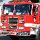
Village Of Elmsford Trustee's Excellent Idea To Help With Flooding

6 posts in this topic

This is a really simple and relatively easy idea, and I wonder why it hasn't been done already. Who is actually responsible for riverbed maintainence?

Bill Zimkin

Trustee, Village of Elmsford

Here are my suggestions of actions that I believe will make a positive difference and they don’t require any engineering.

No matter what all of the studies come up with, the basic fact is that the river and river beds need to be cleaned up. There is so much debris - trees, tires, shopping carts, etc. - that the water flow is impeded and in some cases diverted to a path of flooding areas that don't usually flood. No matter what the engineers come up with, I believe they will start with cleaning up the river and river beds.

If the State partners with all of the affected municipalities, I believe that will be much cheaper and faster than having an independent company do the project. I can't speak on behalf of the Cities, Towns or Villages but I believe they will all be willing to participate.

Example: The Town of Greenburgh uses its DPW personnel to clean up the river and river beds that go thru the Town , Mt. Pleasant does the same etc. The Villages and Cities can also get involved in the process. The State can get involved by helping with the cost of the project by helping with granting all or partial financing for the workers and equipment. If special equipment is needed for some problem areas, it can be purchased and shared by all municipalities. The County and Feds with FEMA can also partner with the project.

Hear is an oversimplified analogy:

When your house gutters are clogged or getting to that point you clean them to avoid flooding in your home. The Saw Mill River is the gutter for our area. (The Bronx River has the same problems)

This will not solve our flooding problems but it will help. When you build in or near a flood plain and do little to no maintenance, ( no intent meant to diminish the work and efforts that has been in the Yonkers and other areas) the result is our present problem. The businesses, the home owners and the local residents will actually see some action as the cleanup project is moving foreword and not hear about studies of unaffordable projects.

This will be faster and cheaper than the bidding process. The documents, permits, bonding and oversights for a project like this would be massive and very costly.

The State, the DEC, the Corps of Engineers and whoever else is involved with confusing something as simple as maintenance, should allow this project to proceed and help financially. I'll bet the municipalities will all be happy to participate.

A coordinated and well timed effort is needed. My suggestion would be to do the project in the spring, after the winter thaw and before August when hurricane season starts. After the initial project is done, this should become a annual maintenance program of each community. Financial aid should also become annual unless the State wants to take on the total responsibility.

With that said, the second project that needs to be done is a little more involved but manageable, but now that we spent the first year on phase one we have had a year to think about phase two.

Some fifty years ago when I was a very young teenager you could actually go swimming in some areas of the Saw Mill River and run around splash water in other areas. Many fished some of the deep areas also.

The River has filled in with silt, run off etc. It is actually shallower than it once was in many areas. The river bed needs to be dredged of all the buildup. I know that is not a new idea but as the river gets shallower the flood level and flood plain keeps getting expanded.

I believe we can come up with a plan that involves the Municipalities again to achieve this goal. They might have to temporarily employ more people to help with the project but that is a good thing, cheaper than the cost of the massive contract document for a project of this size and nature.

Town by Town and Village by Village and City by City, individually doing the same work it is like a lot of small coordinated projects. These small projects will need a coordinated effort with disposal of the silt but with a little coordination and assistance from the State, County and Feds, I think we can manage this project well.

With both of those projects complete, the flooding will be better but it will still happen. None of us have the money or real-estate to make it go away. With a river flowing unimpeded we will have an environmentally friendly and cleaner river with less flooding. The coordinated storm water run off project is also helping with the river being cleaner.

Thank you for your time and listening to my recommendations. The residents need to see action. I think my ideas will help.

Bill Zimkin

Trustee, Village of Elmsford

Share this post


Link to post
Share on other sites


Removing garbage from the streams will not prevent the flooding he is talking about. Dredging or any other modifications to the flow of these rivers is a much larger project that requires study and large scope oversight. The sawmill used to flood annually between the Chappaqua train station downtown Pleasantville due to a hard turn under the railroad and parkway in the area of Hillview drive. The water would back up into the lower yards along washington av and was damaging the train tracks. In response, the army corps of engineers lined the river bed with concrete and plastic. Now there's a very fast moving stream that runs straight into a fairly long section of slight grade. After about 10 years of high efficiency channeling a significant amount of sediment that would normally have been even distributed along the waterway was being deposited along this flat spot in the river. Between the high speed current carrying more sediment and debris, and the concrete bottom's inability to hold plant life that would normally accumulate sediment the problem was accelerated. What was once a stream is now a full on swamp in Pleasantville between Pleasntville Road and Grant St. Where there was a trail 15 years ago is now a soggy mess that you can barely walk through let alone ride. As this ground has become saturated and softened the parkway has sunk placing it at greater risk of flooding. Other changes like building a couple of athletic fields in a swamp and then raising and draining them into the sawmill are also adding to the problems on that stretch.

Rivers flood. We need to take our cues from out west where they have much larger rivers doing much more damage and restore flood plains and natural wetlands. Eliminating the problem here in this one location is only going to move the problem downstream.

Edited by ny10570

Share this post


Link to post
Share on other sites

Ardsley used to flood from the Saw Mill River big time until a project by the US Army Corps Of Engineers basically built a system that resolved the flooding. Except for VF Macy Park, which flooded during every storm until this day. It was kind of designed as a flood plain, anyways.

From biking the old Putnam Railroad line through Ardsley and Elmsford as a kid before it was turned into a bike trail, there were a lot of places where the river got hung up on dead branches, debris, silt, etc and was flooding the railroad bed daily. (made for some very cool mountain biking).

The lake at VF Macy Park (old Cantina Resturant side)was dredged because of Westchester County's failed attempt of making that a recreational pond. The material dredged was pumped over to the Saw Mill River Road half of the park to make raised athletic fileds, that were not prone to flooding. Due to Westchester's excellent insight, they thought the sludge would take a year to dry, when it actually took multiple years and is still not 100% dry. There is still a dam that was built there that is not properly maintained, and does nothing to help "flush out" debris nearby downstream.

In Yonkers, the section of the Saw Mill that runs from the Hastings Border 'til about Executive Blvd. was dredged, cleaned, and rebanked several years ago. Also, supposedly the lower Saw Mill River that's been encased in a tunnel running under downtown Yonkers for decades is going to be reopended. Once they remove all the bodies and debris, I wonder how that will affect river flow? There are also some flood walls in Yonkers, mostly near Neppehan Ave. The only time, and this was Ardsley too, I remember the river filling up to the brink of the wall was during Hurricane Floyd in the late 90's.

As for Babbit Ct. in Elmsford (Town Of Greenburgh, Fairview Fire District), it floods during almost EVERY storm. And every time, the Town Of Greenburgh and the residents seem suprised.

I totally agree with you that some natural flood plains need to be maintained. However, the rivers in Westchester have really turned into just flood channels, and nothing more. And flood channels, the most famous is the Los Angeles River where many movies and TV action scenes are show, need to be maintained and cleared of debris routinely, especially in heavily wooded areas such as Westchester.

Also, just a question-is the "swampy" area anywhere near the shooting range?

Share this post


Link to post
Share on other sites

Cleaning the river is a good thing to do. Building burms along the river so that low lying areas immediately adjacent to the river is wise. Constructing concrete river botoms and embankments certainly made a difference in flooding along the Saw Mill in Ardsley and Yonkers.

However, the root cause of all the flooding, now ocurring on a regular basis, is the overdevelopment and the establishment of impervious surfaces.

Impervious services prevent the absorbtion of runoff into the ground. Instead, water runs down and around the impervious surfaces, dumps into a storm drain (and sometimes a sanitary sewer.....but that's a discussion for another day) and into a river. The river fills up with silt and debris, the river slows and flooding ocurrs.

When development is proposed, municipal planners generally are able to detect and identify the "water" impact of the development. However, in the end, the almighty short term $$ euphoria always, always trumps logical environmental planning.

Edited by dadbo46
Bnechis and efermann like this

Share this post


Link to post
Share on other sites

Yep, that shooting range was on the opposite side of the parkway. I haven't been there in a while, but I'm pretty sure the range is no more.

Over development has been an issue forever and the increase in storm run off is absolutely adding to the problem. Since you cannot undo the development of the river's watershed devices like berms, levees, lined stream beds or other attempts at stopping flooding only make the problem worse. The river needs to flood, managing that flooding is the only best solution. The only other option is turning the entire thing into an LA style flood channel, but who wants that running through their community? While a lot of money is being spent on restoring the river's flow through Yonkers much of it will forever remain running through sluices and channels at least as long as downtown Yonkers continues to exist.

Share this post


Link to post
Share on other sites

In a few words, the rougher the channel, the lower the discharge, the lower the discharge the lower the velocity. The Manning Coeffiecent denominator in the Manning equation identifies that the rougher the channel, the lower the discharge, since the velocity of the water as well as the slope of the reach and the area of the cross section are all numerators, they are modified by the denominator, the higher the denominator, the lower that makes the effect of the numerator divided by the denominator smaller. Since than answer to numerator/denominator is discharge in the Manning Equation, the higher the denominator or surface roughness, the lower the discharge. Since discharge and Northeastern Streams flood stages are related, the lower the discharge, the lower the flooding.

A smooth channel like in LA floodways only moves high volumes of water further down stream where they either flood somewhere else or enter to ocean. To control stream flooding, make the channels rougher, decreasing both volume and velocity thus dropping discharge again, thus reducing flooding. A rough mountain stream in a well drained flood plain will experience almost none of the destruction that we witnessed across the East Coast due to Irene. Only when we modify existing features, changing existing morphology do we create conditions that will be detrimental to human features.

To best remove flooding concerns, improve riparian corridors, remove smooth channels, remove unneeded damns, restore flood plains and don't be surprised when it flood again. We are the problem not water, not the storms and not the environment. We made this problem ourselves, no one and nothing did it to us. We have been doing what we have been doing for a few thousand to a few hundred years, these processes and functions have been on going for millions. Nature always bats last, she never loses and she always bats 1.000.

Edited by SRS131EMTFF
ny10570 likes this

Share this post


Link to post
Share on other sites

Please sign in to comment

You will be able to leave a comment after signing in


Sign In Now
Sign in to follow this  
Followers 0

  • Recently Browsing   0 members

    No registered users viewing this page.